At this rate, how long can we use resources?
Step 1: Go to the ArcGIS Online map, North American Landforms, and explore the map.
Step 2: Click Modify Map, then click the Show Contents button (on the Details pane).
Step 3: Turn on the Landform Marker layer; you will now see an Edit button at the top.
Step 4: Click the Edit button and then click the Landuse Marker.
Step 5: Click and drag the cursor around the map to “sketch” similar continuous regions, based solely on their appearance. (If necessary, zoom in to see more detail.)
- Describe how many unique regions you choose?
Step 7: To stop drawing, click the Edit button.
Step 8: If needed, click the button Show Contents (in the Details pane).
Step 9: Turn off the World Shaded Relief layer by clicking the checkbox.
Is there more to landforms than texture.
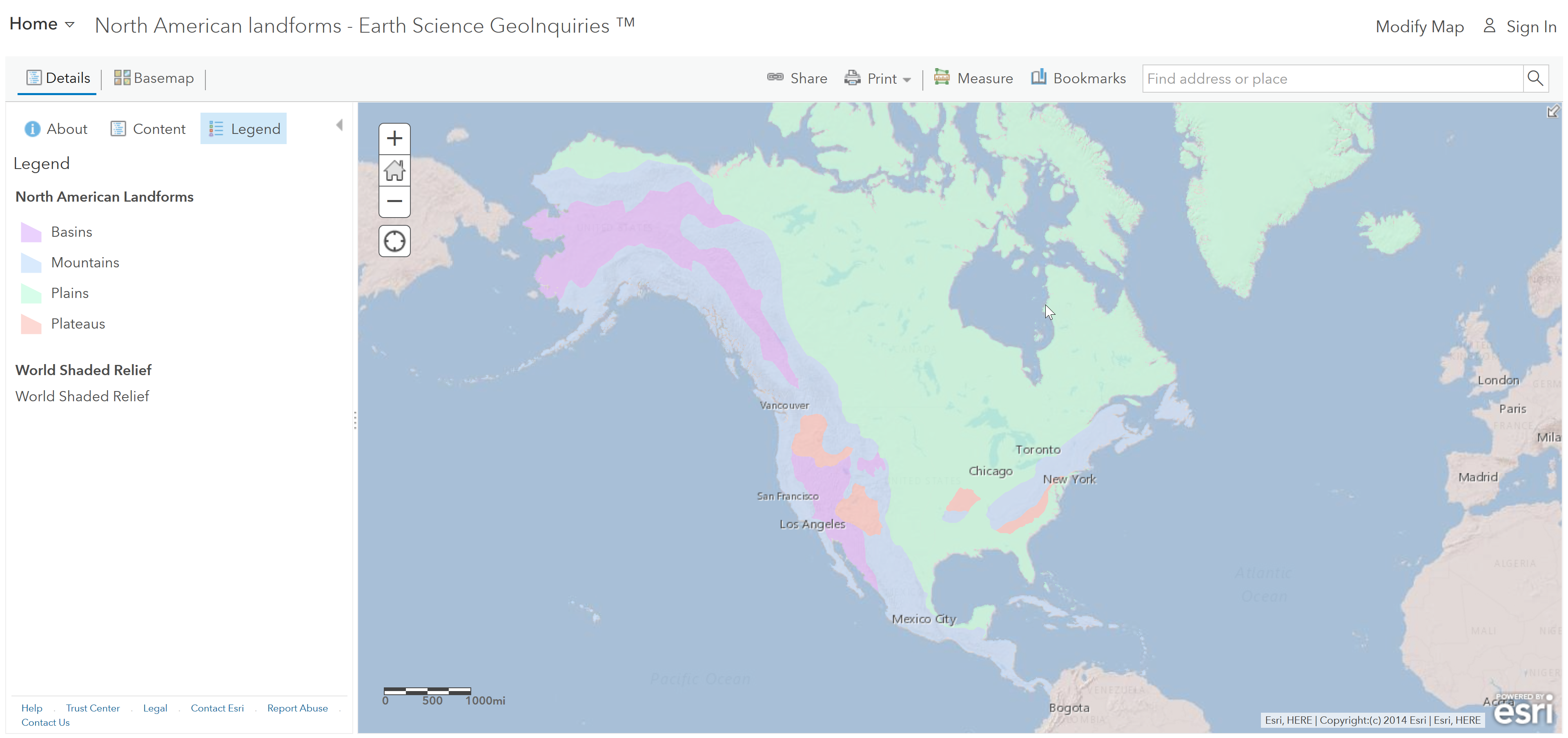
Step 10: Turn on the North American Landforms layer.
Step 11: Click the Basemap button, and then click Topographic.
- Which color is used to show the plains?
Step 12: Click several places across the plains.
- Which of the following are considered plains?
- Coastal plains get more precipitation and are more moderate in temperatures than mid-continental plains. T/F
Note how the imagery Basemap shows greener areas in the plains, particularly along the Gulf Coast.
Would a bay by any other name, sound the same?
Step 13: Click on each bookmark. Identify and differentiate among various types of landforms, as listed below.
- Coastal features
- Freshwater regions
- Ocean bodies
- River-formed landforms
- High elevation terrains
- Large ice features
Identifying landforms in your area
Step 14: Search for any of the landform types found in your local area. Use the Find Address Or Place search tool.
- Explain what the selected landform is and how it differs from similar features (e.g., those in Elaborate). ? If you have chosen a local cape, for instance, how is this different from a barrier island?
